


by Dennis Dalman
It’s been a long time coming, but plans for an ambitious street improvement project in east Sartell are now approaching a final form.
At a public hearing during the Aug. 13 city council meeting, more than a dozen east-side residents voiced their concerns to the council. Those concerns included assessment questions, water-flooding issues and requests not to widen all the streets to a 32-foot width.
After the hearing, the council voted unanimously, 5-0, to proceed with the next stage of the plans. The project can begin in May 2019.
Background
For years, the succession of city councils in Sartell have talked of plans to make improvements and add amenities to Sartell’s east side, the portion of the city in Benton County to the east of the Mississippi River.
Some of the improvements were made, including amenities to Val Smith Park and, most recently, the major reconstruction of CR 29, which is mainly a county project. That project is still underway.
In 2014, street improvement proposals were presented to the city council. In November 2015, a public information meeting took place at city hall, followed by another public information meeting in August 2017. In March 2018, the council ordered a feasibility report and a preliminary assessment hearing that would be presented at the Aug. 13 council meeting.
The report
The feasibility study was presented to the council at the Aug. 13 meeting by April Ryan, project engineer for the city’s contracted engineering firm of Short, Elliot, Hendrickson Inc.
Using overhead graphics and maps, Ryan gave an outline of three areas for improvement.
There will be a partial mill and overlay done on Scott Drive, which will make the first section of that road 32-feet wide for a distance of 356 feet, and the rest of the road will remain its current urban-street width of 36 feet. The Scott Drive improvement will make the entire stretch of road good for 12-foot to 14-foot driving lanes, as well as an 8-foot parking lane. The storm sewer along the road will also be replaced.
A full-reconstruction project will involve improving streets and replacing or updating storm sewers, sanitary-sewer lines and the water main. The streets will be widened to 32 feet, allowing for two 12-f00t driving lanes and an 8-foot parking lane.
The roadways for full reconstruction are the following: Second Avenue NE, Third Avenue NE and Fourth Avenue NE (the section between First Street to 160 feet north of Third Street NE), as well all the streets from Second Street NE (the section between Third Avenue and Fourth Avenue) to Eighth Street NE (the section between First Avenue NE and Third Avenue E).
Alley reconstruction (resurfaced with a bituminous layer) will be done between First Avenue E and Second Avenue E as well as an alley just off of Scott Drive.
The third portion of the east-side roads project will be a mill-and-overlay of the following roadways: Fourth Avenue E, Fourth Avenue NE (160 feet north of Third Street to the north end), Fifth Avenue E, Eighth Street NE from Third Avenue E to the east end, Ninth Street NE from Third Avenue E to the east end, 10th Street NE, 11th Street NE, Highway Drive W and High Drive.
Those roadways will be 36 feet wide, except for Eighth Street NE, which currently is 38 feet wide. The roads will be redone with an 8-inch milled edge and a 2-inch bituminous overlay.
Costs
The entire project, all three portions, will cost an estimated $7,179,000. The overlay work will be paid entirely by the city, and assessments to residents will help cover the other portions of the project.
The city’s total cost is $6,628,000, which means about $500,000 must be raised through assessments.
The planners decided to place a cap on assessment costs to make it easier for property owners to bear the burden. The cap will be an assessment amount of 8 percent of estimated market value of a resident’s property or $8,000, whichever is less. Assessments will show up on the 2020 tax statements. It was also noted there will be another tax assessment hearing after the plans and designs are finalized.
One speaker at the public hearing thanked the city for the assessment cap, noting he and other neighbors in east Sartell are blue-collar workers mainly and certainly not millionaires.
That same speaker, along with some others, questioned the need to widen all the roads in the project, partly because neighbors there do not want to lose the stately trees near the current roadsides – oaks, basswood, silver maple. The speaker, who had been laid-up because of surgery, said he recently observed traffic by his home one morning from 5 – 9 a.m., and there were only 16 vehicles.
Why, he asked, is there a need for 32-feet wide urban-standard roads in a quiet neighborhood? Some streets in that area are 24, 25 and 27-feet wide, he noted.
Sartell City Engineer Jon Halter took note of speakers’ comments and questions during the hearing. The plans, he said, are by no means finalized, and engineers are willing to work residents for individual problems and concerns, including efforts to save as many trees as possible and to consider allowing some road widths in some areas to remain.
Council members also weighed in on road widths and agreed roads should not be widened in some places if at all possible.
Other improvements
The storm-sewer pipes on east side of Sartell are a kind of mish-mash of various ages and sizes, and there are breakages here and there in the pipes, as well as root-intrusions, as videos have shown.
The project will replace and improve the sewer and water system, ensuring that it is more uniform, consistent and functional to an optimal level.
Twenty fire hydrants will be replaced as part of the east-side project.
A pond storage-drainage system in that area will also be developed.
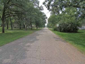
This roadway in east Sartell is one of many on that side of the city that will be redone next spring. The fix-it projects are expected to start in May 2019 and will cost more than $7 million, funded by city money and assessments to residents of that area.